Stirling’s City Walls
Assessing Scotland’s best-preserved medieval defensive walls
Funding from the Society of Antiquaries of Scotland supported Dr Murray Cook FSAScot and Stirling Archaeology in assessing Stirling’s City Walls with a team of volunteers in 2024.
Introduction
The history of burgh walls in early modern Scotland is often overlooked in discussions of municipal defence, overshadowed by more prominent structures like castles. Factors such as limited archaeological visibility and reliance on documentary evidence contribute to this neglect (Creighton & Higham 2005: 16). Compared to larger, more imposing European town walls, Scottish examples are smaller and less preserved, with few receiving significant academic attention. Stirling’s City Wall (the Wall) is Scotland’s best-preserved early modern defensive Wall and a Scheduled Ancient Monument (SM1754). Existing research, primarily based on 1950s fieldwork (RCAHMS 1963: 304-6) and 19th-century studies by Ronald (1899), focuses on documenting features rather than exploring the Wall’s broader significance. With the RCAHMS report nearing seventy years old, there is now an opportunity to refresh the narrative using multidisciplinary methods that integrate topographical studies, architectural analysis, documentary sources and archaeological investigation.
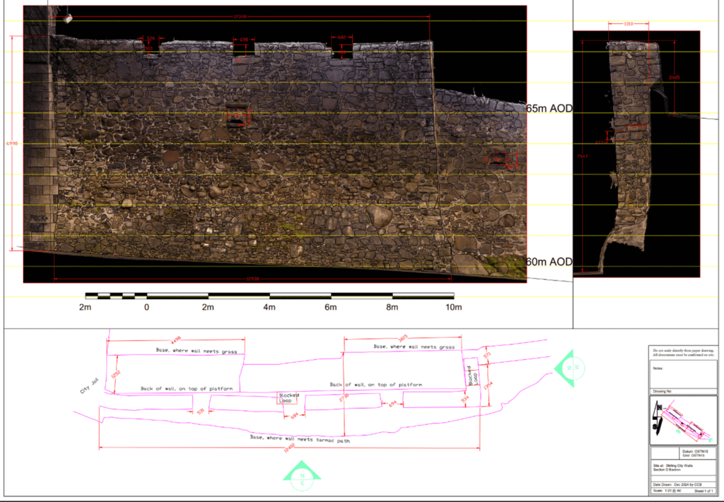
Section drawing of bastion A0 on Stirling’s City Wall © Murray Cook
Architectural Survey
Previous studies of Stirling’s City Wall provided limited architectural detail, leaving significant gaps in understanding its construction, functionality and defensive design. Essential features such as the Wall’s total length, thickness variations, and the arrangement of gun loops, which are essential for analysing its tactical and defensive purposes, were largely unexplored before this research. To address these gaps, a comprehensive survey was undertaken in November 2024 using a Trimble X9 terrestrial laser scanner and a high-precision GNSS receiver. This technology produced a 3D colourised point cloud model and highly accurate 2D representations of the Wall, capturing intricate architectural details essential for interpreting its construction phases and defensive features. Laser scanning, renowned for its accuracy and efficiency in acquiring dense, georeferenced data, was particularly suited to this large-scale project. The method facilitated precise documentation of key features, including gun loops, bastions, and wall dimensions, offering new insights into the Wall’s design and the threats it was constructed to counter. A key focus of this study was the bastion at St John’s Street, which was the key focus of the Society’s grant. The bastion was surveyed, photographed, and rendered into detailed 2D drawings.
While laser scanning has some limitations, such as challenges in processing large datasets and capturing areas obscured by vegetation, its advantages far outweigh these drawbacks. Alternative methods, including photogrammetry and traditional hand-drawn techniques, were considered but deemed unsuitable. Photogrammetry, while cost-effective and portable, is less effective for high-elevation structures due to difficulties in achieving consistent coverage and relying on extensive ground control points. Drone-based photogrammetry was also excluded due to health and safety risks and regulatory restrictions in the Wall’s urban setting. Traditional hand-drawn methods, though valuable for interpretative analysis, are time-consuming, prone to human error, and lack the precision of modern digital tools. Laser scanning was chosen for its ability to balance precision, efficiency, and practicality, enabling a detailed and accurate reassessment of Stirling’s City Wall.
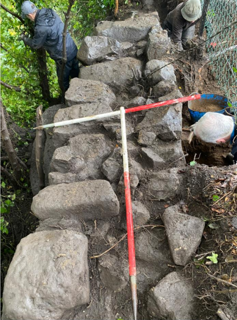
Volunteers cleaning in Trench 2 on the outward side of the wire fence adjacent to the cliff edge © Murray Cook and Dominic Farrugia
New Findings on the Wall’s Design and Function
The architectural survey is a key component of a broader research initiative aimed at uncovering valuable new insights into the origins, design, functionality and current condition of the Stirling Wall. While the RCAHMS previously dated the Wall to 1547 (RCAHMS 1963: 304), during the period of the ‘Rough Wooing’ (Marshall 1906), this research will suggest that construction began three years earlier, spurred by political pressures on Mary of Guise from Henry VIII and the Scottish Regent, the Earl of Arran. Mary of Guise’s efforts to protect the young Princess Mary appear to have been the driving force behind the Wall’s construction, making its story inseparable from the fortunes of the crown and Stirling’s strategic significance. The Scottish defeat at Pinkie in September 1547 (Caldwell, Olesky & Rhodes 2023: 19) further heightened tensions, accelerating construction and offering a rare glimpse into how a community responded to a national crisis.
Archaeological excavations (see Data Structure Report) have revealed significant new details about the Wall’s alignment, construction phases, and integration into Stirling’s broader defensive topography. These excavations uncovered previously unrecorded sections and bastions, shedding light on the Wall’s strategic design. The study will demonstrate that the Wall embodies a sophisticated, low-curtained design with flanked bastion defences, reflecting the latest European Renaissance military architecture. This evidence reinforces the Wall’s significance as a modern and innovative fortification strategically tailored to the evolving threats of the mid-16th century.
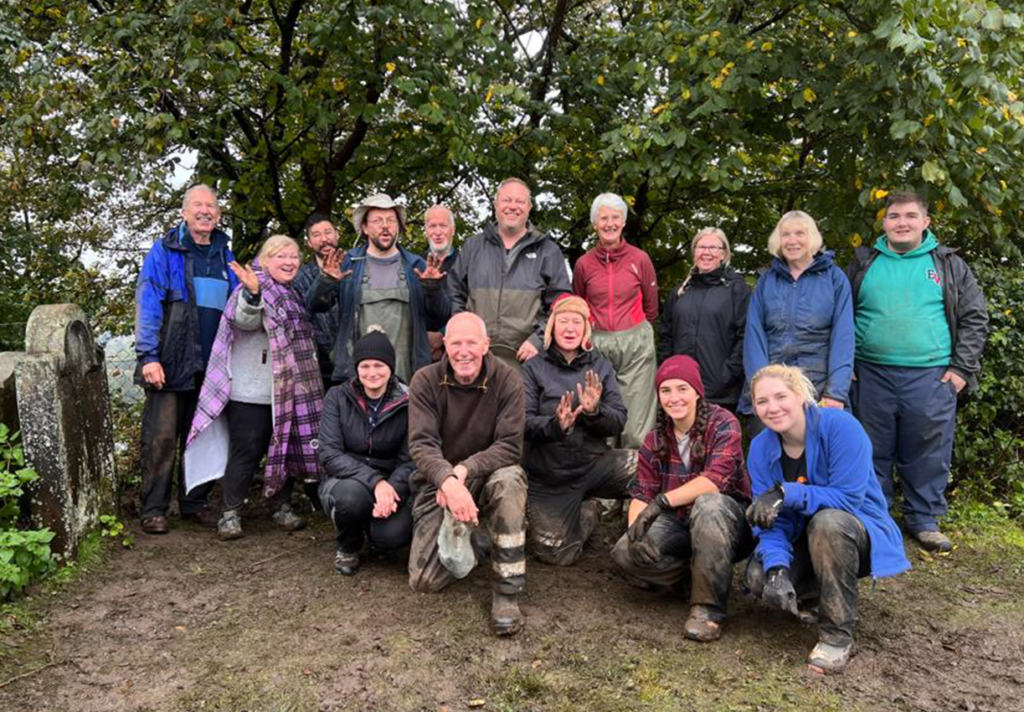
Volunteers working at Stirling’s City Wall © Murray Cook and Dominic Farrugia
Community Engagement and Cultural Value
Beyond its academic contributions, this research has also engaged with the local community, fostering a deeper cultural identity and pride. The excavation phase provided an opportunity for public involvement, enhancing the Wall’s cultural value and reinforcing its role as a vital part of Stirling’s heritage. These efforts highlight the importance of integrating community engagement into archaeological and heritage projects to ensure historical monuments’ continued relevance and preservation.
Future Publication
The findings from this research will form the basis of a new publication, which will be offered to the Society for consideration and potential publication. This work enhances our understanding of the Wall’s historical and architectural significance and sets a precedent for combining archaeological investigation with community involvement in heritage research. Through this study, the Wall’s story is revitalised, providing a richer narrative of its role in Scotland’s history and its enduring impact on the local community.
References
Caldwell, D., Oleksy, V., Rhodes, B. (2023). The Battle of Pinkie, 1547. Oxford: Oxbow.
Marshall, H.E. (1906). Scotland’s Story: A History of Scotland for Boys and Girls. Edinburgh: Thomas Nelson & Sons. https://archive.org/details/scotlandsstoryhi00mars/mode/2up. Accessed 02/11/2024.
Ronald, J.R. (1899). Landmarks of Old Stirling. Historical Print Edition. London: British Library.
RCAHMS (1963). Stirlingshire: An inventory of the ancient monuments Vol 2. 1st Edition. Edinburgh: RCAHMS.
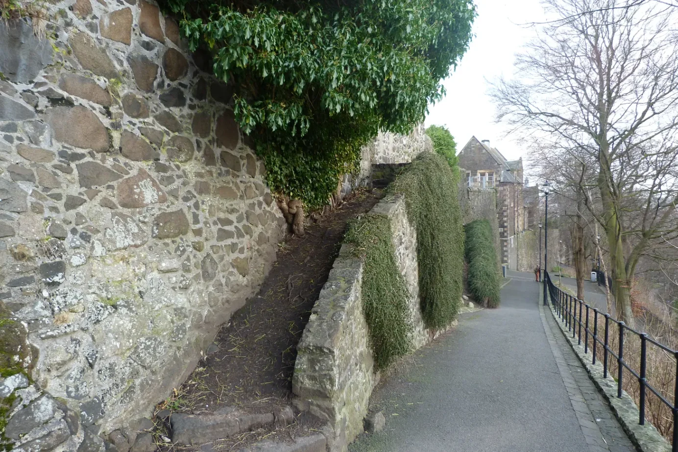
Featured image: Section of Stirling’s City Wall © Murray Cook