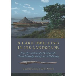
Graeme Cavers and Anne Crone 2018, A Lake Dwelling in its Landscape, Iron Age settlements at Cults Loch, Castle Kennedy, Dumfries and Galloway, Oxford, Oxbow Books, ISBN 978-1-78570-373-7, 304pp, rrp £36. Reviewed by Dennis Harding. 
The Cults Loch excavation project developed out of the Scottish Wetland Archaeology Programme’s (SWAP) research agenda, a key tenet of which was the study of crannogs in their landscape context, integrating terrestrial, underwater and wetland contexts. ‘Crannog’ is a portmanteau term, covering a diversity of site types, disparate in their topography, structural attributes and function, with notable regional differences. The Cults Loch complex is focused on a small kettlehole loch in a fertile agricultural landscape that attracted settlement throughout prehistory. Though it has a crannog in open water (Site 1), this was not the subject of excavation in the present programme, which concentrated on what is termed the ‘promontory crannog’ (Site 3) at the northern end of the loch. It was linked to the shore by a short causeway, though possibly had originally been just off-shore. Though the excavators identified a succession of structural activity in the form of corduroy foundations and floors, the evidence for substantial superstructure is minimal. A case can certainly be made for roof-supports being based on sill beams, but residential occupation rather than working activity is far from proven. The observation that upright timbers could be withdrawn for reuse from the soft sediments without leaving stratigraphic trace is well made, but nevertheless sounds like special pleading. The artefact assemblage typically was aceramic, but the absence of spindle whorls or bone implements (which would not have survived unless burnt) leaves a question mark over the site’s use. Environmental evidence suggested animals were not kept on the crannog, but were probably corralled nearby.
Two other adjacent sites were investigated. The promontory fort (Site 4), located on a spur of land between the loch and marshland to the west, was defended on its southern access by multiple palisades and ditches, initially detected from air-photographs and subsequently confirmed by limited excavation. A palisaded enclosure (Site 5) to the east of the loch proved on excavation to contain a pair of substantial, successive ring-groove houses,14m and 13.5m in diameter respectively, the earlier (Roundhouse A) with two concentric internal post-rings, the later (Roundhouse B) with just one. Roundhouse B was distinguished by two, diametrically opposed entrances, a phenomenon now quite widely recognized in Northern Britain (Harding, 2017: fig. 2.12). It also appears to have had internal access to a short, timber-lined souterrain, the first to be excavated of a type now widely recognized from air-photography in the south-west, and here apparently dating to the closing centuries bc. A test area opened at random north of the loch (Site 6) revealed a number of grave-like pits (without surviving trace of burials), from which a single radiocarbon date spanned the opening centuries ad, that is, broadly contemporary with the only available date from the crannog at Site 1.
Treating terrestrial, wetland and underwater sites as part of a unified landscape is a laudable objective, though the hitherto undetected presence of Site 6 provides a clear warning that surface evidence, air-photography and geophysical survey may still fail to reveal the full extent of occupation. Then there is the problem of chronology and demonstrating contemporary activity. From radiocarbon dating it is statistically possible that Sites 3, 4 and 5 were in contemporary use in the fifth century bc, but equally it is possible that they were sequential, the sequence being Site 5, followed by Site 3, followed by Site 4. The excavators are adamant on the basis of dendrochronology that use of the promontory crannog was of short duration, just a couple of generations in total, perhaps with periodic episodes of disuse within that, consistent with the current view that longevity of Iron Age settlements has generally been over-estimated. The ring-groove houses on Site 5 are substantial buildings, but apart from the major reconstruction represented by the later roundhouse, there is little evidence of structural repair to support protracted use of either. The problem is that Sites 3, 4 and 5 each have very different structural components, so that, if sequential, they must indicate radical changes in functional activity every couple of generations. As ever, research excavation ends up posing as many new questions as it resolves.
This report is well presented and by today’s standards is reasonably priced. My only quibble would have been for features referred to in the text by number to have been clearly numbered on the plans, such as posthole 317 (p145) on Illus 117, or curvilinear cut 249 on Illus 122. In the case of the latter, we are told (p162) that 249 cut 124, whereas on Illus 122, assuming one has correctly identified the features, the opposite would appear to be the case. Renaming Roundhouses 2 and 1 as A and B in chronological rather than excavated sequence may have seemed like a sensible rationalization, but there is always one reference (p171) that eludes the editor. These issues aside, this is an important and authoritative contribution to a key regional research programme.
Reference
Harding, D. W. 2017 The Iron Age in Northern Britain: Britons and Romans, Natives and Settlers, 2nd edition, Abingdon, Routledge.
Dennis Harding was Abercromby Professor of Prehistoric Archaeology at the University of Edinburgh, 1977-2007 and Vice-Principal 1988-91.
